Strategic town planning

Strategic town planning is a broad term that refers to the vision for an area and the policies and strategies that implement this vision. It covers everything from how tall buildings are permitted to be, where different land uses should be located (residential, commercial, etc.), to the design of buildings to ensure comfort, sustainability and resilience. Development assessment is the implementation of strategic town planning policy.
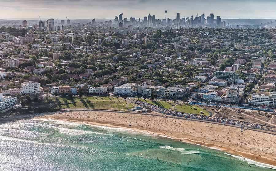
Waverley is geographically small for a Local Government Area (LGA) but is also the second most densely populated LGA in NSW, includes the biggest central business district in the eastern beaches (Bondi Junction) and is home to one of Australia’s most popular tourist attractions (Bondi Beach). As such, effective town planning is crucial to keep Waverley a great place to call home, do business and visit.
State, regional and local planning
In New South Wales, planning is considered at a state, regional and local level.
- At the state level, the Environmental Planning and Assessment Act 1979 outlines how land can be used. Although the Act is dated 1979, it is regularly updated. The Environmental Planning and Assessment Regulation 2021 is a companion to the Act, and provides more detailed information about how planning and development should occur. State Environmental Planning Policies (or ‘SEPPs’) consider specific themes of planning such as housing, transport and environmental conservation or cover specific locations.
- At the regional level, Sydney is considered to be three cities with the Waverley Local Government Area falling into the ‘Eastern Harbour City’ and part of the Eastern City District. Regionally significant decisions are considered by Planning Panels, with the Eastern City District having a dedicated panel.
- At a local level, planning can be thought of in two broad areas:
- Waverley has its own Local Environmental Plan (LEP) and Development Control Plan (DCP), which are the local application of state and regional regulation, polices and plans. These two core documents are commonly used because they guide the assessment of Development Applications by Council’s Development Assessment team.
- The Waverley Local Strategic Planning Statement 2020 - 2036 is the local application of the District Plan and outlines the vision for the neighbourhood in terms of infrastructure, liveability, productivity and sustainability. Many Urban Strategies then feed into how that vision is delivered locally, and these are collated below.
Urban strategies
Council has a large array of policies, procedures and plans that govern everything from how to seek permission to remove a tree, to how infrastructure will be created for cyclists.
Urban strategies are focussed on planning elements and cover specific topics. In publication date order, the current strategies are:
- Waverley Heritage Policy 2007
- Bondi Junction Evening Culture and Entertainment Strategy 2018 - 2028
- Waverley Creative Lighting Strategy 2018 - 2028
- Local Housing Strategy 2020 - 2036
- Our Liveable Places Centres Strategy 2020 - 2036
- Bondi Junction Urban Design Review Update 2020
- Waverley Council Heritage Policy Final Draft Report (Part 1, Part 2) 2022 with proposed changes to the Local Environment Plan currently under consideration by the NSW Government (more information)
- Sustainable Visitation Strategy 2024 (Note, Council is currently working on the new Strategy)
Who is in charge of planning?
In New South Wales, ultimately it is the state government who decides how land can be used. For instance, even though Waverley has its own Local Environment Plan, changes to this instrument must be endorsed by the state government as the Waverley LEP is state government legislation. Similarly, the Environmental Planning and Assessment Act 1979 sets out how LEPs, DCPs and SEPPs should function.
Should Council and the state disagree over a planning matter, there are means for Council to contest a decision on behalf of residents, but these are generally limited.
Similarly, if an individual resident disagrees with a planning decision by Council and/or the state, there are means to pursue a review. The most common is requesting a review regarding a Development Application decision.
How does the community have input into planning?
Waverley’s Community Engagement Strategy outlines the means in which local residents and business are consulted during the planning process.
The most common form of community engagement is when residents can express their views on a particular Development Application via a submission.
Council also requests community feedback on a wide range of matters, from how a particular street should be upgraded, to lifeguard operations to flood preparation. All residents can opt-in to be notified of these feedback opportunities via Council’s Have Your Say website – simply register and opt-in to the various topics of interest to you.
The Precinct committee system is another means for grassroots planning involvement, and residents can also talk to their local Councillor.
If you are unsure about how to take part in a planning engagement process, Contact Us.
